Around the fairgrounds: a loop of Forest Park
The 1904 World's Fair filled this park with palaces for one summer. A walk or ride around it today traces the fair's outline through lakes, lawns, woods and the few buildings that stayed.
A park that hosted the world
Forest Park opened in 1876 on what was then wooded country west of the city limits. It is large by any standard, considerably bigger than Central Park in New York, and it took the city decades to fill it with roads, lakes and lawns. Then, in 1904, the western half of the park was handed over to the Louisiana Purchase Exposition, the World's Fair that marked a century since the United States bought the Louisiana Territory from France.
For seven months the park was a city of plaster palaces, canals, statues and exhibits from around the world. Millions of visitors came. When the fair closed, almost all of it was taken down, and the land went back to being a park. What remains is the layout: the long axis from Art Hill down to the water, the lagoons, the open lawns where the exhibition halls stood, and a handful of structures built to last.
The loop described here covers the main sights in roughly six miles, an easy half day on foot or a couple of hours on a bicycle with stops. The paved path that circles the park is the backbone of the route; most of the places along it are free to enter.
Starting at the northeast corner
The Forest Park-DeBaliviere MetroLink station sits just outside the park's northeast side, and it makes the natural start. Walk south to Lindell Boulevard and you reach the Missouri History Museum, built after the fair on the site of the exposition's main entrance. Its long-running exhibit on the 1904 fair is the best preparation for the walk: photographs of the vanished palaces make the empty lawns ahead much easier to read.
From the museum, head into the park toward the east. The paths lead past the lakes in this part of the park, which date from before the fair, and which were a favorite spot for rowing even in the 1890s. In warm months, boats can still be rented here.
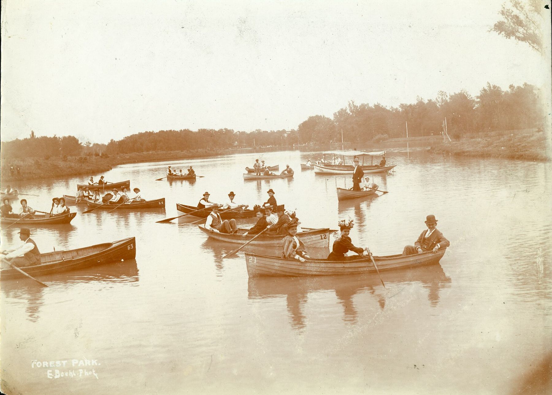
The old photograph shows how long this has been a place for leisure: families in hats and their best clothes rowing slowly under the trees, a short streetcar ride from the crowded brick city.
The World's Fair Pavilion and the Jewel Box
South of the lakes, on a rise known as Government Hill, stands the World's Fair Pavilion. It was not a fair building at all; it was built a few years after the exposition, paid for with money the fair had left over, and placed on the hill where the U.S. Government Building once stood. It is an open, arcaded shelter with a tiled roof, and from its terrace you look down a slope of lawns and fountains toward the park drives. Many people use it for picnics, weddings and gatherings, and it is a good spot to rest and take in the view.
Not far away is the 1936 Jewel Box greenhouse, whose stepped glass walls catch the light from far across the park. Nearby, the trees hide the great fan of seats of the Muny, the outdoor musical theatre that comes to life on summer nights.
Mile 5.9The museum at the top of Art HillThe Grand Basin and Art Hill
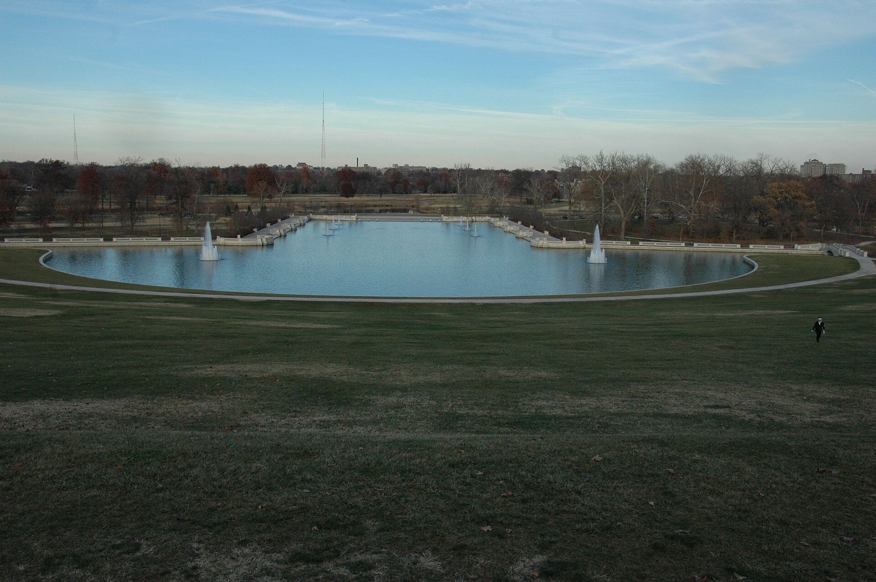
Head west from the Muny, and the park opens into its most famous view. The Grand Basin is a long rectangular pool with fountains, surrounded by stone balustrades and lawns, set at the foot of a broad grassy slope. During the fair, this was the heart of the exposition: palaces lined the waterways, and the slope above held a cascade of fountains that tumbled down toward the basin.
The cascades are gone, and the slope is now Art Hill, a sweeping lawn with the Saint Louis Art Museum at the top. The basin was restored in the early 2000s, with new fountains, walkways and balustrades, and it is again the centerpiece of the park.
Climb the hill to the statue of King Louis IX on horseback, then turn around. From the top, you can see the basin below, the trees of the park beyond and, on a clear day, the tops of buildings in the distance. The art museum on Art Hill is the only major palace of the fair that still stands, and its general admission has long been free.
From the top, you can see the basin below, the trees of the park beyond and, on a clear day, the tops of buildings in the distance.
West through the woods and back
From the museum, the path heads west and south through the less developed parts of the park, where woods, prairie plantings and a stream create a different landscape. The River des Peres once flowed through this ground on the surface; for the fair, it was diverted into a covered channel beneath the grounds. In recent decades, parts of the park have been replanted with native trees and grasses, and the stream has been partly returned to the surface as a series of waterways and pools.
These woods are quieter than the rest of the park, and they are popular with birdwatchers in spring and autumn. Look for trail markers and small signs along the unpaved paths, and stay on the marked routes.
The Saint Louis Zoo, with its 1904 Flight Cage, lies to the south of the art museum, and you can add it as a detour from this part of the loop. From the western edge of the park, near Skinker Boulevard, the path turns back along the northern side of the park, past golf courses and lawns, toward the starting point.
If you want a longer loop, keep to the southern edge of the park instead. Near the highway stands the planetarium, a thin, curved concrete shell from the 1960s shaped a little like a cooling tower. It belongs to the city's science center, and like the other big institutions in the park it has long offered free general admission, with charges for some exhibits and shows. Check before you go.
Practical notes for the loop
- The paved path that circles the park has separate lanes for walkers and for cyclists and skaters in most places. Keep to the correct lane.
- Bicycles can be rented near the park in season; check what is available before you go.
- Summer days are hot and humid. Start early, carry water and take breaks in the shade or inside the museums.
- The park is busy and well used during the day. After dark, stay on lit paths and drives, as in any large city park.
- Seasonal shuttles and events change the park's traffic and access; check before you go.
Back at the northeast corner, the MetroLink station returns you to the line toward downtown and the river. In a single loop, you have walked across the grounds of the World's Fair, seen the buildings it left behind and spent a morning in one of the great city parks of the country.