The riverfront · Laclede's Landing
Steel over the river, stone underfoot
The first great steel arch bridge over the Mississippi still carries trains and walkers, and at its western foot a few blocks of cobbles and warehouses remember the old riverfront.
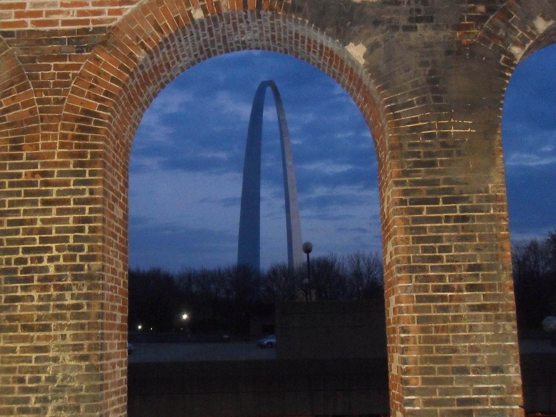
A few minutes' walk north of the Arch, the riverfront changes character. The lawns end, the ground rises toward a row of old brick warehouses, and a long bridge of three steel arches reaches out across the Mississippi to Illinois. This is the Eads Bridge, and the small district at its foot is Laclede's Landing, named for the man who founded the city on this bank in 1764.
The bridge they said could not be built
When the Eads Bridge opened in 1874, nobody had spanned the Mississippi this far south. The river here is wide, deep and full of shifting sand, and steamboat owners wanted nothing in their way. James Buchanan Eads, a self-taught engineer who had made his name salvaging sunken boats from the riverbed, designed a bridge of three ribbed arches, each more than 500 feet long, built largely of steel at a time when the metal had hardly been used in a major structure.
The piers were sunk to bedrock inside huge pressurized chambers called caissons. Workers dug in the compressed air far below the water, and many came up with what was then a mysterious illness, now known as decompression sickness. More than a dozen died of it during construction. The bridge was a triumph of engineering and a hard lesson in what that triumph cost.
A well-worn story says an elephant was led across on opening day, on the old belief that the animal would refuse to step onto an unsafe span. Whatever the details, the bridge has carried traffic ever since: horse carts and streetcars first, then cars, and now light-rail trains on the lower deck and cars, bikes and people on the upper one.
Walking across
The upper deck has a walkway separated from the traffic lanes, and the walk to the Illinois shore and back takes most people under an hour at an easy pace. The view south from the middle of the river is the one to come for: the Arch standing over the treetops of its park, the downtown towers behind it, and the brown water sliding underneath.
The deck is exposed. Wind comes straight down the river valley, and in summer there is no shade at all, so go early or late on hot days and bring a layer in spring and fall. The east end lands in East St. Louis, where there is little to walk to near the bridge; most people turn back at the far shore.
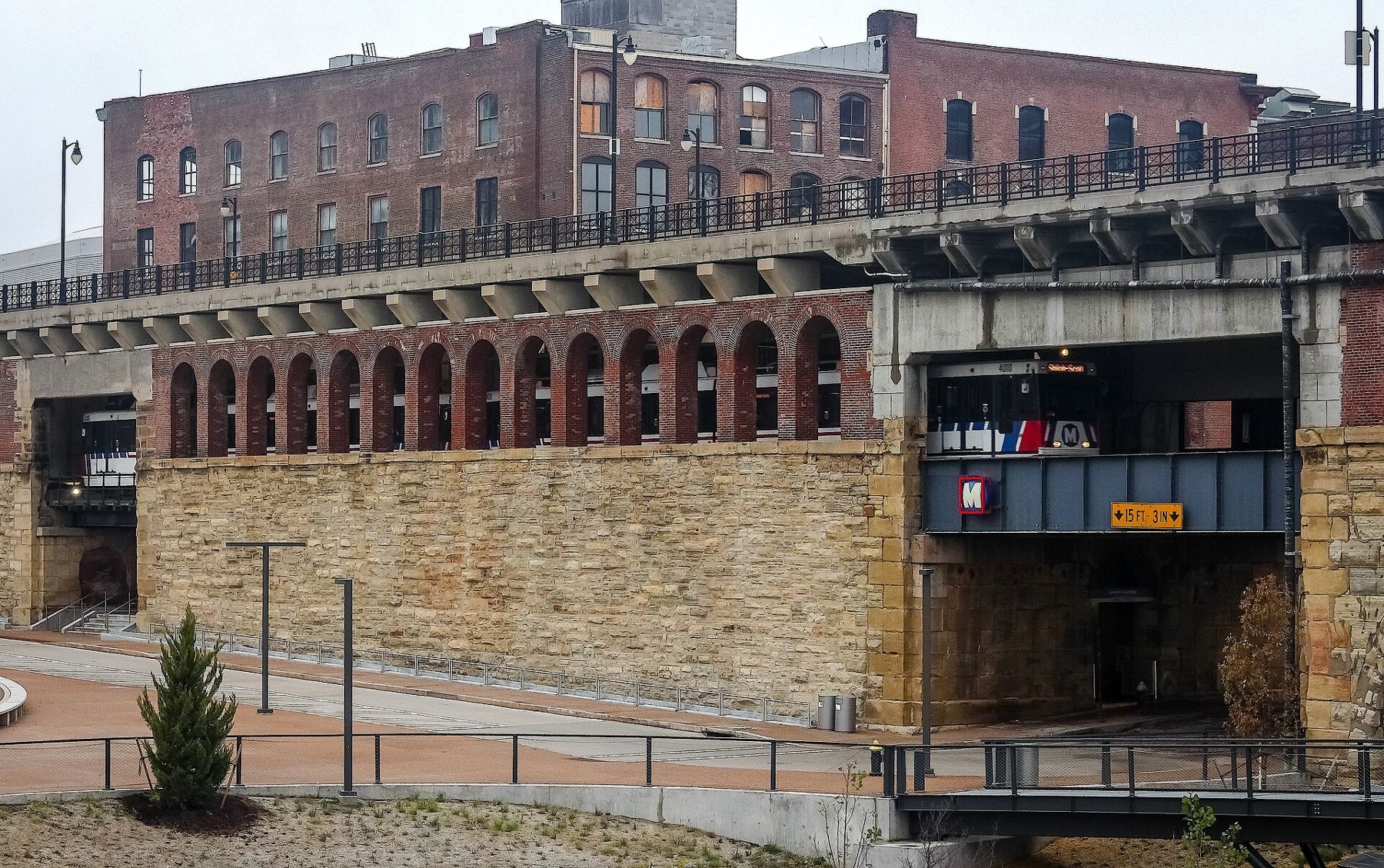
Look down as you go. Below the roadway, MetroLink trains cross on the lower deck, and the riveted ribs of the arches curve away underneath, close enough to see the bolts. On the city side, the bridge does not end at the bank; it runs on as a stone and brick viaduct over the riverfront streets, and the light-rail line follows it into a tunnel under downtown.
Mile 0Mile 0: the Gateway Arch and the leveeThe landing's cobbled streets
When the riverfront to the south was cleared for the Arch, these few blocks survived. They are the last piece of the warehouse district that once lined the whole levee, and they still have the grain of the nineteenth-century city: narrow streets laid with stone setts, loading doors set high in the walls, cast-iron columns along the ground floors, and brick buildings five and six stories tall that stored tobacco, hardware, groceries and dry goods brought up from the boats.
Walk slowly here. The paving is uneven, and the curbs are high in places where the streets were raised over the years. Many of the warehouses were converted to offices and apartments, and the ground floors hold places to eat and drink, busiest at night and on weekends when there is a game or a show downtown. In daylight on a weekday the streets are quiet enough to hear your own steps on the stone.
Look for the small details. Iron shutters still hang on some windows. A few walls carry the ghosts of painted advertisements. The cast-iron columns that once stood on the old levee buildings, saved when those blocks came down, were brought back here to stand among their surviving neighbors.
The floodwall and the river's edge
North of the landing, the city meets the river behind a long concrete floodwall. It is part of a system of walls and levees that protects downtown, and it earned its keep in 1993, when the Mississippi reached its highest crest on record at St. Louis. Riverside gates in the wall close when the water rises.
Stretches of the wall have been painted over the years, and the riverfront trail runs along its river side for miles to the north. The trail is flat, paved and good for a long bike ride or run, though it passes through quiet industrial land with few people about. Go in daylight, take water, and treat it as you would any long, lonely path in a city.
Getting here and moving on
The Laclede's Landing MetroLink station sits right under the bridge approach, with stairs up to the landing's streets. From here, one stop east crosses the river on the bridge's lower deck, which is the cheapest and easiest way to ride over the Mississippi without walking it.
The obvious next step is south to the Arch grounds, five minutes away along the river. If you want to keep to the old city, walk west to the Old Courthouse and its dome, then ride MetroLink west toward midtown and the park.
When to come
Late spring and early fall give the best light on the bridge and the most comfortable walk across it. Summer evenings are pleasant once the sun drops, and the view of the lit Arch from the middle of the bridge after dark is one of the best in the city. In winter, the wind on the deck can be bitter, but the crowds are gone and the river runs gray and steaming on the coldest mornings.
When the Mississippi is high, parts of the riverfront road and trail close, and the landing's lowest corners can be fenced off. Check conditions before you set out after heavy spring rain upstream, which is when the river most often climbs.