The riverfront · Gateway Arch
Mile 0: the Gateway Arch and the levee
A stainless steel curve as tall as it is wide, a cramped tram that climbs inside it, a museum under the lawn, and a river that sets the whole city's compass.
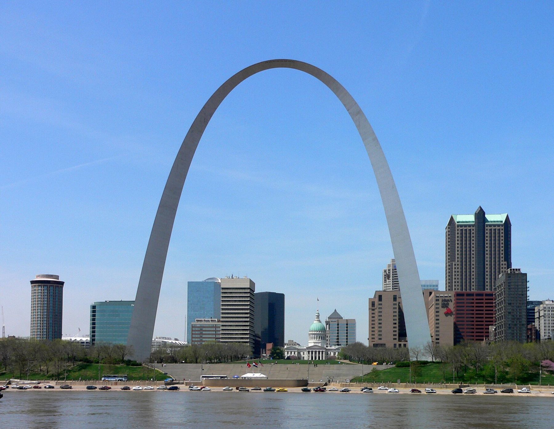
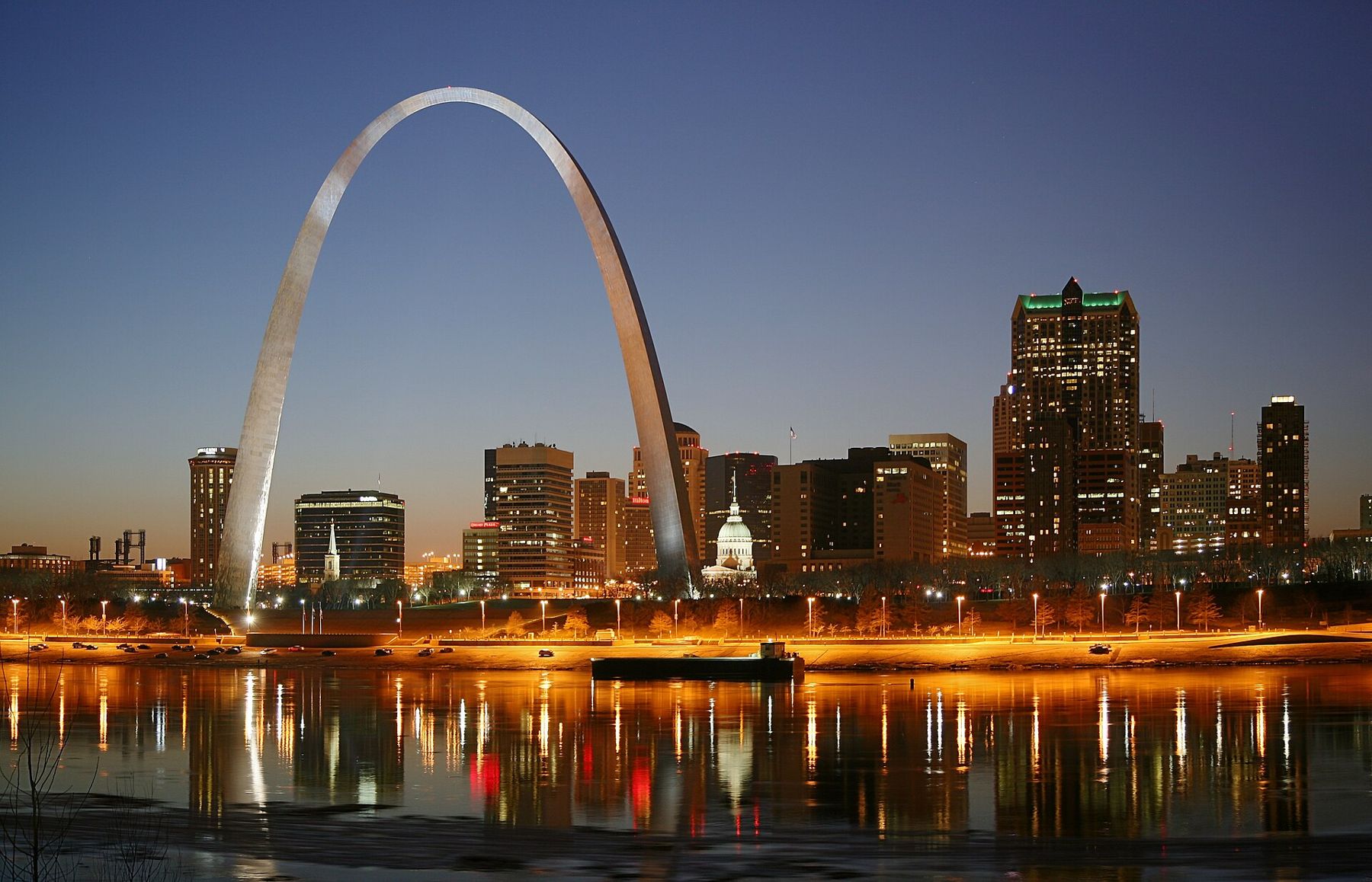
Every distance on this guide is measured from here. The Gateway Arch stands on the west bank of the Mississippi, 630 feet tall and 630 feet across at its base, and from almost anywhere downtown it shows up at the end of a street, between two buildings, or as a flash of steel over a rooftop. It was finished in 1965, the last section fitted into place at the top that October, and it has been the city's signature ever since.
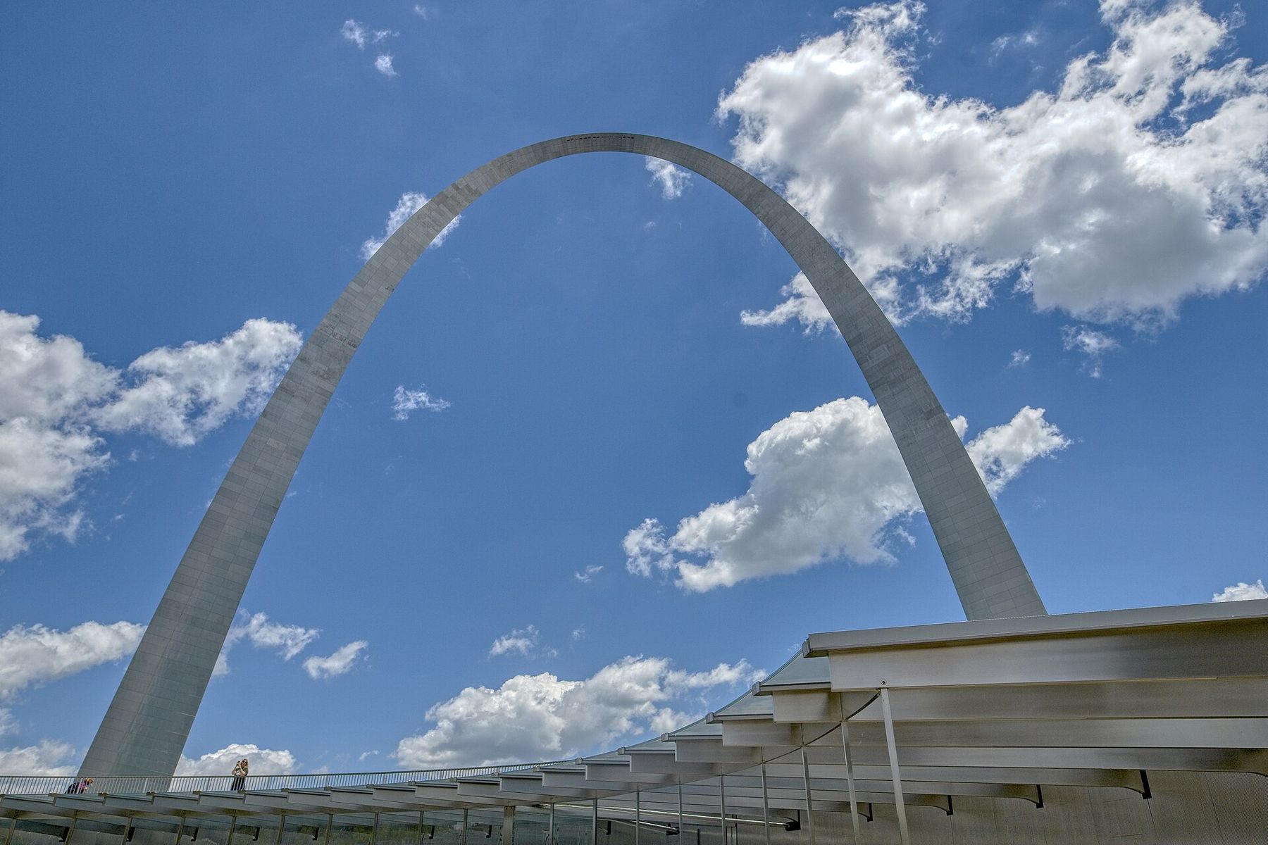
The shape is a weighted catenary, the curve a hanging chain makes when you hold it by both ends, turned upside down and made slightly heavier at the base. The legs are triangular in section and taper as they rise. The skin is stainless steel, which is why the Arch changes color through the day: pale gray under cloud, gold at sunset, nearly white in hard noon light.
The ride to the top
The trip up happens inside the legs, in small egg-shaped capsules strung together like a short train. Each capsule seats five people knee to knee under a low curved roof, and the cars tilt to stay level as they climb the curve. The ride takes a few minutes each way. Through a little window in the capsule door you can watch the stairs and the inner framework slide past.
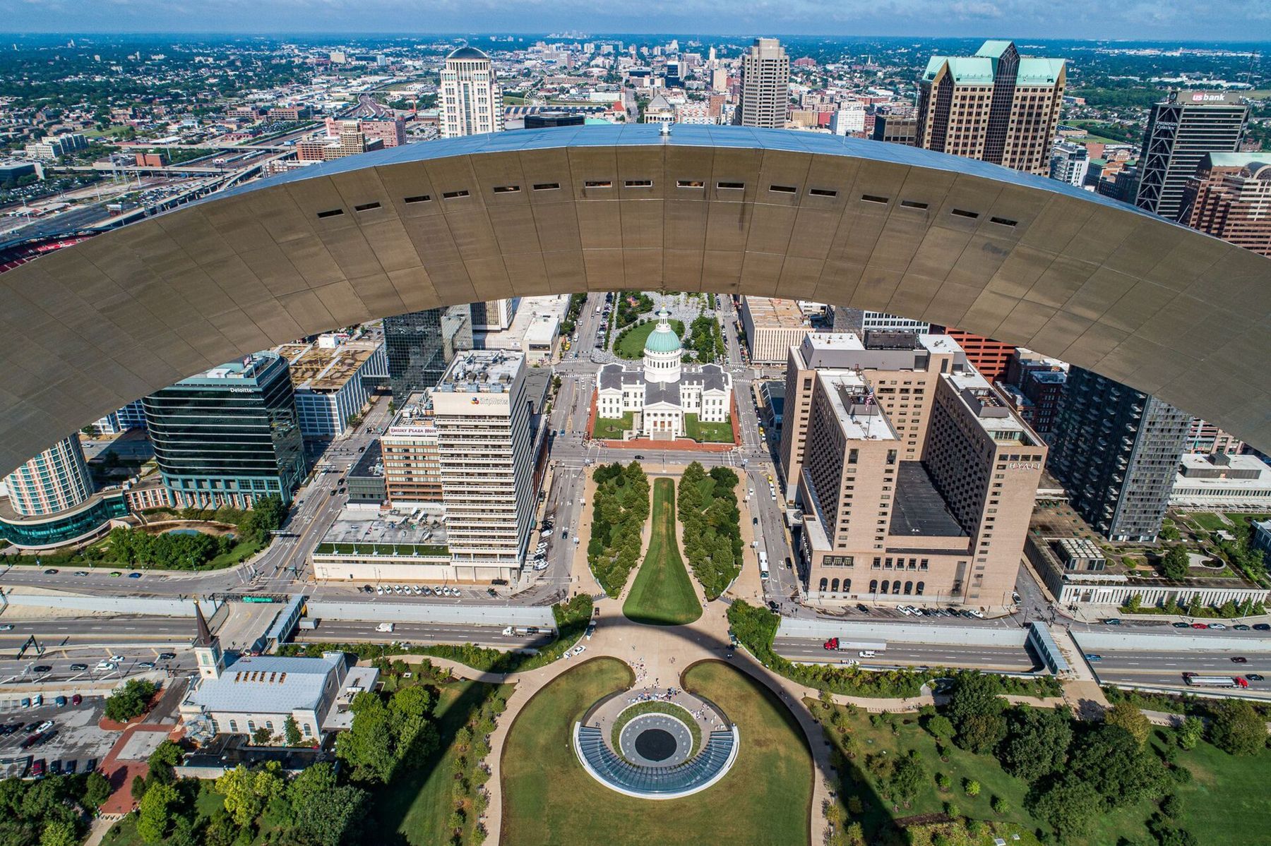
At the top is a narrow observation room bent along the curve, with small slot windows on both sides. To the east you look across the river into Illinois; to the west the whole downtown grid opens out, with the green dome of the Old Courthouse directly below the line of your view. On a clear day the city runs on toward the trees of Forest Park, where this guide ends.
The capsules are tight. If small spaces bother you, ride the shortest trip of the day, early, and keep your eyes on the window. Anyone with mobility concerns should ask staff about the route before buying a ticket, since the top of the ride involves a short climb of steps to the viewing area.
Tram tickets are timed, and on busy days the slots sell out well ahead. Prices, times and the rules for what you can bring through security change, so check with the National Park Service or its booking service before you go rather than relying on anything printed.
The museum under the lawn
Between the legs, the ground slopes gently down to a glass entrance on the west side, facing the Old Courthouse. Below it lies the visitor center and a museum that tells the story of the city's founding and the push west across the continent. The galleries run in rough time order: the French settlement of 1764, laid out by Pierre Laclède and the young Auguste Chouteau; the Louisiana Purchase and the transfer of the territory; Lewis and Clark; the fur trade, the steamboats, the wagon roads; and the costs of all that movement for the nations already living on the land.
There is also a good section on how the Arch itself went up, with the two legs climbing separately and creeper cranes riding up their backs until the final piece was fitted between them. It is worth reading before the tram, because the ride makes more sense when you know what you are riding inside. General entry to the museum has been free, with the tram and the film charging separately; confirm that before you go.
Mile 0.4Under the dome, a family's case for freedomThe grounds and what was here before
The park around the Arch is the national park, a long lawn with ponds, curving walks and rows of trees designed in the early 1960s. For most of the twentieth century you reached it by crossing the highway. Since a landscaped lid was built over the interstate, you can now walk straight from the Old Courthouse to the Arch on grass, which makes this the natural start of a walk west along the city's spine.
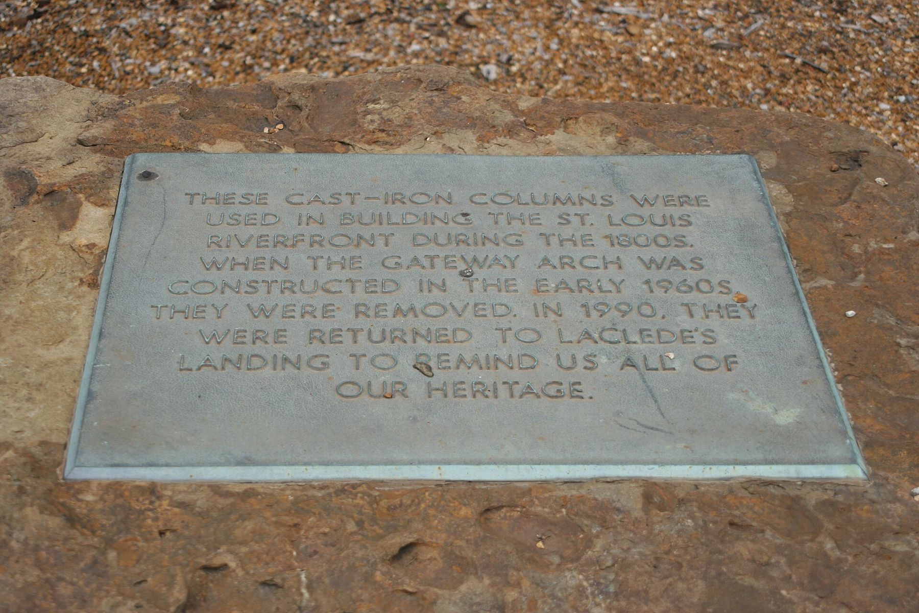
The ground under all of it was once the oldest part of St. Louis. Around forty blocks of warehouses, cast-iron storefronts and narrow streets were demolished from 1939 onward to clear the site for a national memorial. Some of the buildings were in poor shape; others were the finest commercial architecture the city had. Pieces were saved. A set of cast-iron columns from the old riverfront ended up a few blocks north on the cobbled streets of the landing, and you can find them still.
The one building left standing is the Old Cathedral, the stone Basilica of Saint Louis, King of France, finished in 1834 on land set aside for a church since the French founding. It sits at the southwest corner of the grounds, small beside the Arch, and is still a working parish. Its neighbor several miles west, the newer Cathedral Basilica, is a very different building and worth seeing on the same day if you ride the train.
Down to the levee and the river
East of the Arch, broad stairs drop to Leonor K. Sullivan Boulevard and the levee, the sloping stone bank where steamboats once tied up in long rows. This is the oldest working edge of the city, and it still floods. When the river is high the boulevard closes, and in the record flood of 1993 the water climbed far up the stairs. When it is low you can walk the levee and see the current at close range: brown, fast and wider than it looks from above.
Excursion boats tie up along this stretch in season, and barge tows push slowly past toward the bridges. A short walk north brings you under the steel arches of the Eads Bridge, finished in 1874 and still carrying trains and walkers over the water.
The river path along the levee is flat and open to the sun, with little shade. In summer, walk it early or toward evening. In winter the wind off the water is raw, and the steel of the Arch stays cold to the touch long after the sun comes up.
Timing a visit
Spring and fall are the gentlest seasons here. Summer brings heat and humidity that sit on the open lawns, and the longest lines for the tram. Weekday mornings are calmer than weekend afternoons. If the tram is sold out, the grounds, the museum and the levee still make a full half-day.
Every distance on this guide is measured from here.
For the best view of the Arch itself, go across the river or stand on the Eads Bridge at dusk, when the legs pick up the last light. From the city side, the classic framing is from the steps of the Old Courthouse looking east, with the Arch filling the end of the green mall.
Getting here is simple. The Laclede's Landing MetroLink station sits a short walk north, and the 8th & Pine station is a short walk west past the Old Courthouse. Once you have seen the river, start walking the other way: the rest of this guide follows the MetroLink line and the old streets west toward the park, through a city that, as you will notice block after block, is mostly built of red brick.